Project
Urban Flood Risk Simulation
City-scale hydrodynamic flood model at 5 m resolution — driven by observed rainfall, with no tuned parameters, checked against independently reported flood locations.
- Role
- Flood Simulation & Hazard Modelling — NetMob 2026 team
- Period
- 2026 – —
- Status
- Ongoing
- Stack
- Python · 2D Hydrodynamics · LInA Solver · LiDAR DTM · GIS · NumPy
Where this sits in the portfolio
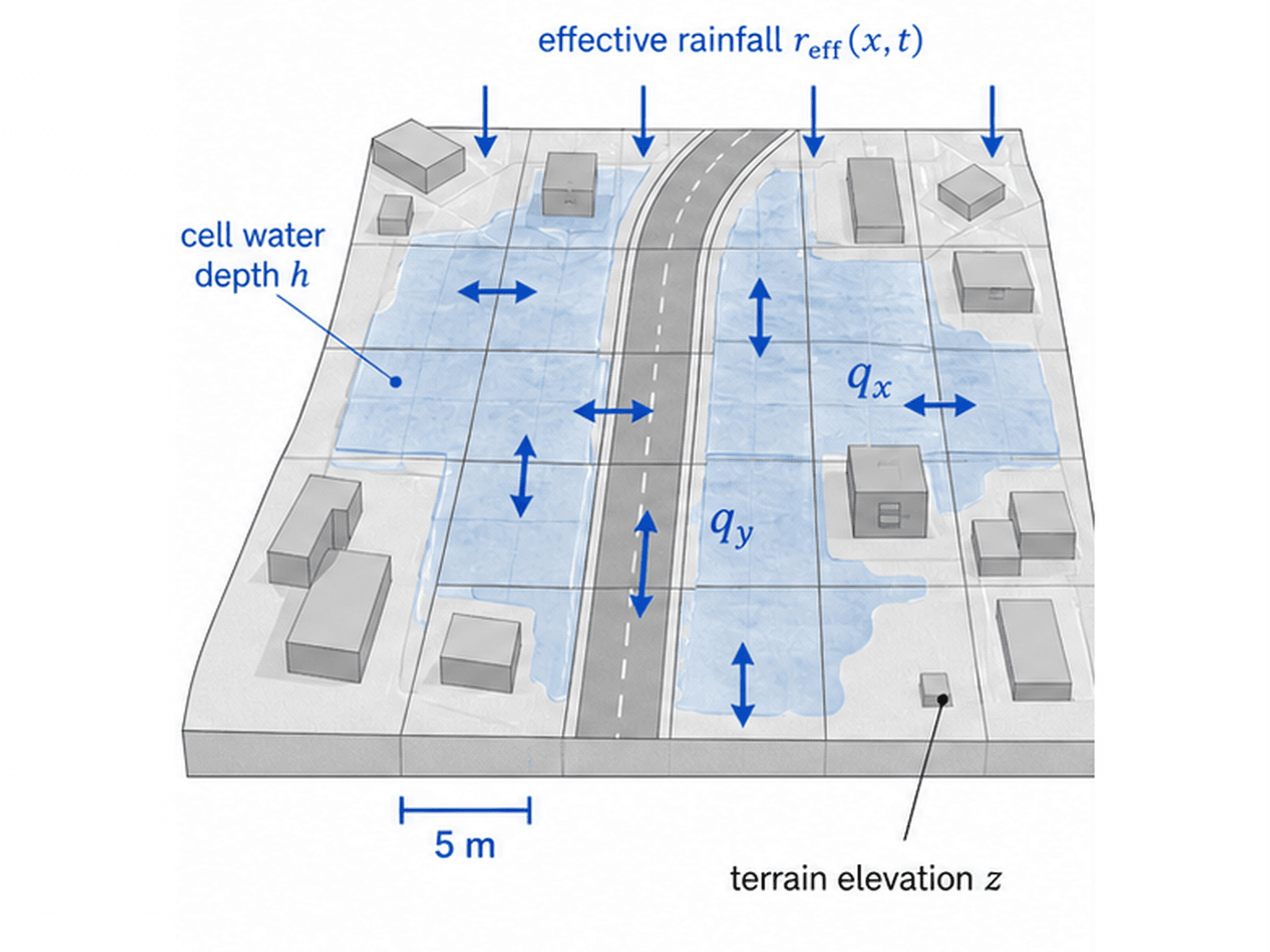
A city-scale hydrodynamic flood model for Niterói, Brazil, built as the hazard layer of a NetMob 2026 study on how rainfall flooding reshapes access to public transit. My part of the work is the simulation itself: turning observed rainfall into a street-resolution map of where water actually stands, and making that map defensible enough for everything downstream to rest on.
The chain runs from 15-minute gauge rainfall through a Modified Horton infiltration scheme into a 2D local-inertial solver on a 5 m grid over LiDAR terrain, with uniform Manning roughness and an explicit mass-balance diagnostic at every time step. The solver keeps local acceleration, the water-surface gradient and friction, and drops advective acceleration — enough physics for urban ponding without paying for the full shallow-water equations across an entire city.
The model is not calibrated. No parameter was tuned to fit any observation. It was then frozen and checked against flood locations reported independently during two 2026 storms: at every reported site the model puts water on the ground, and no terrain sink falls inside a validation window — so the agreement is not an artefact of a pit in the elevation data.
That check has a limit worth stating plainly, and the figures state it too: all eight reported locations fall in non-favela census tracts, which means the validation has no coverage of precisely the neighbourhoods the wider study is about. Reported-flood data is a record of who gets written about, not of where water goes.
The paper is currently under submission, and the underlying mobility data is governed by the NetMob 2026 data challenge agreement. This page therefore shows method and hazard-field output only.
Gallery
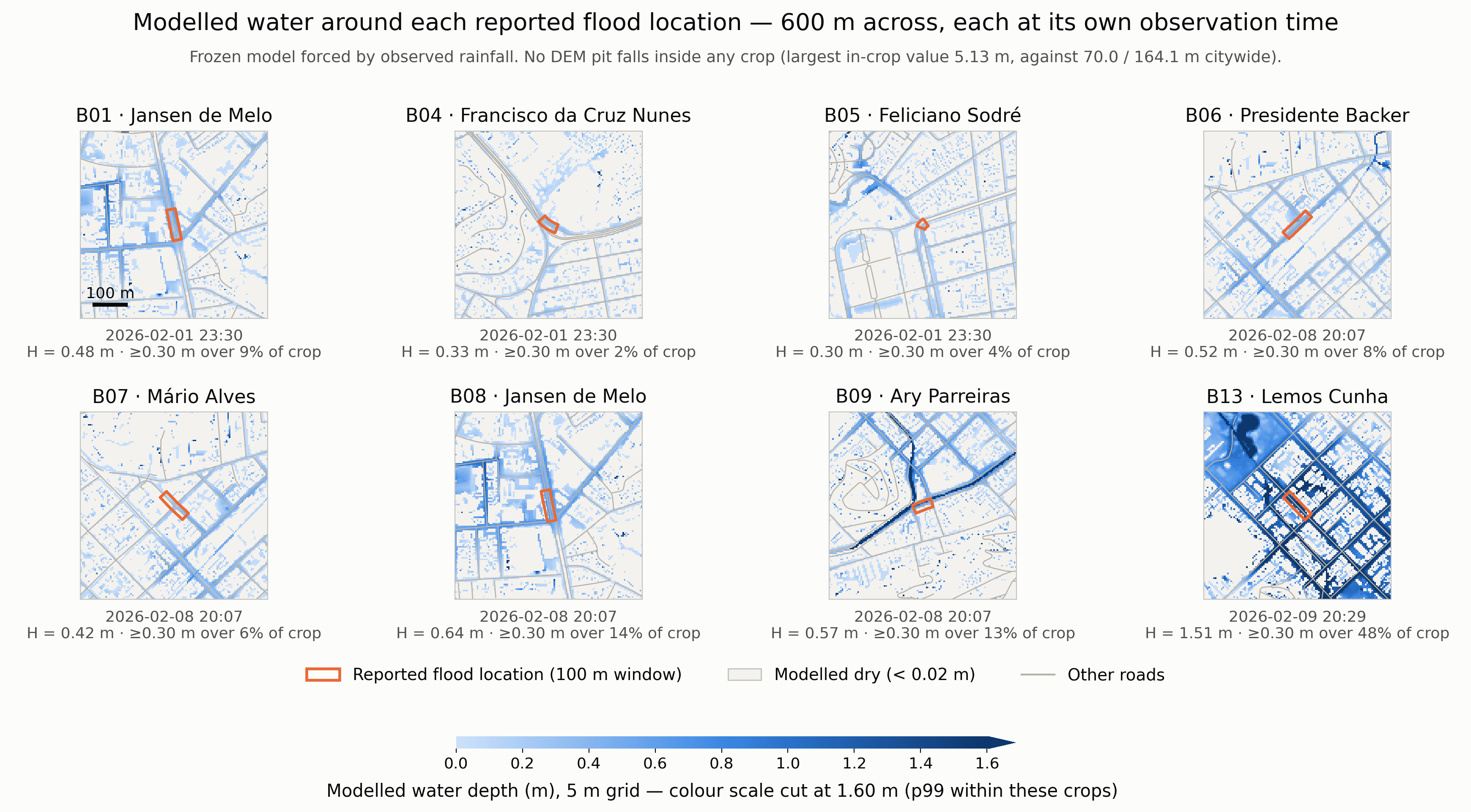
Modelled water depth around each reported flood location, every panel at its own observation time. Frozen model forced by observed rainfall — no parameter tuned.